The city of New York or New York City (NYC) is one of the most developed cities of the world. It is not only the biggest city of the USA but also the most populous one in the country. It is known for its skyscrapers and modern architecture but do you have an idea how it used to look before it became New York City?
In 1664, when British took the control of New Amsterdam from the Dutch, they renamed it as New York after the name of Duke of York. NYC is the USA’s biggest city since 1790 and it was also the capital of the country from 1785 to 1790.
Here are some photographs of New York City from the 1800s when it was undeveloped with the photographs of the same location in today’s time, just to give you an idea how much New York has changed.
1Times Square
Advertisement
Times Square is an important business intersection of the city along with one of the most visited tourist attractions as almost 50 million visitors come here annually. It has been developed as the entertainment center which is also called “The Crossroads of the World” or “The Heart of the World”.
Here is Times Square of 1920:
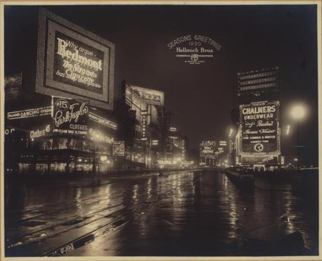
Image Source: www.businessinsider.in
This is Times Square of today:
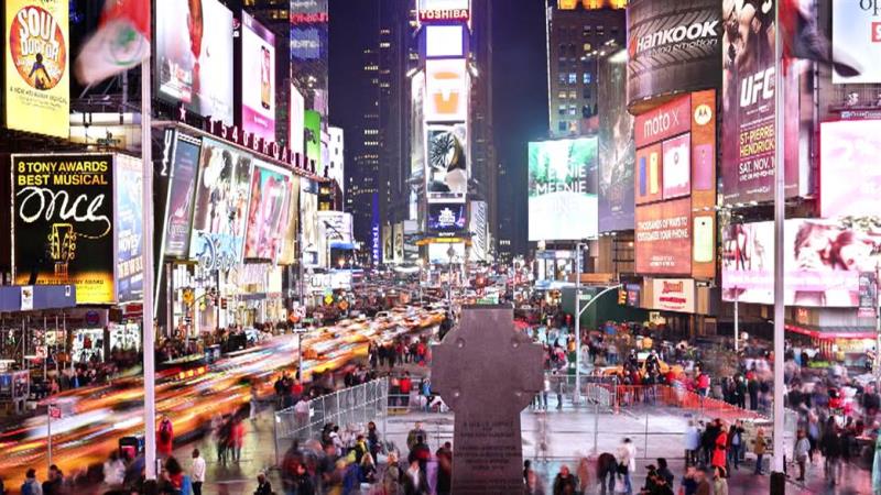
Image Source: media2.s-nbcnews.com
2Madison Avenue
Advertisement
It is named after Madison square which got its name after James Madison, the fourth President of the USA. Madison Avenue runs from Madison Square till Harlem River Drive and the areas that it passes through are Midtown, the Upper East Side (including Carnegie Hill), East Harlem and Harlem.
Here is how it looked in 1836:
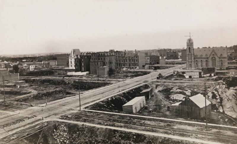
Image Source: baomoi-photo-1-td.zadn.vn
This is how it looks like today:
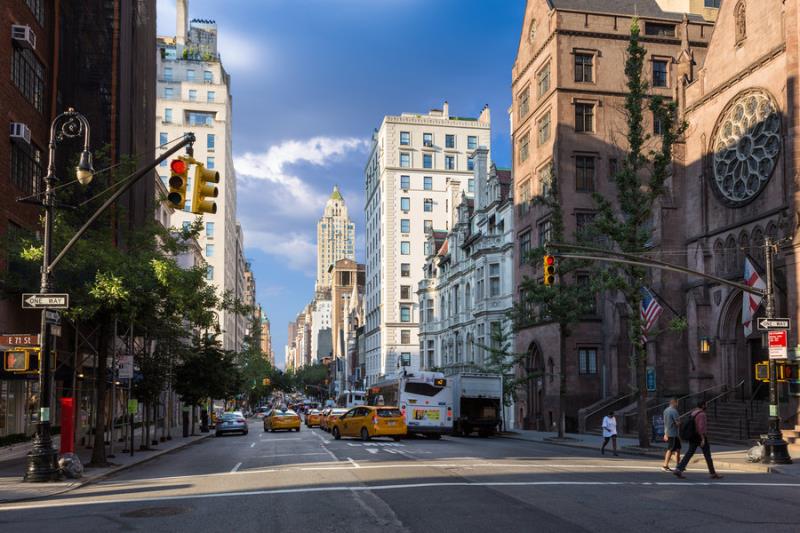
Image Source: www.departures.com
3Intersection on the 8th avenue in 1925
Advertisement
In 1925, the intersection on 8th avenue used to look quite different but now it has become the major transportation hub of the city. Port Authority Bus Terminal has been set up there, which is main gateway for interstate buses and it is owned and operated by Port Authority of New York and New Jersey.
Here is the 8th avenue in 1925:
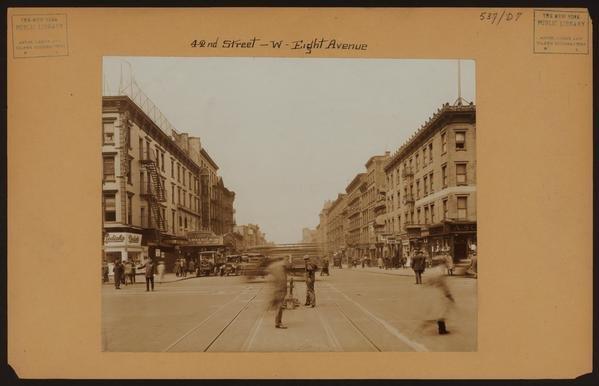
Image Source: content.argaam.com
And it looks like this nowadays:
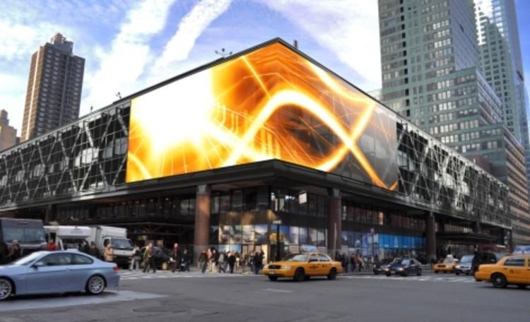
Image Source: images.adsttc.com
4West village
Advertisement
It is the neighborhood in the Lower Manhattan which is mainly residential with lots of shops and small restaurants. It is a part of Manhattan community board 2 and also of the Sixth Precinct of NYPD. The West village of 1927 used to give a very rustic feeling:
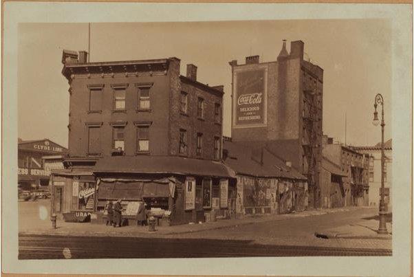
Image Source: www.snyar.net
And now it has a modern look:
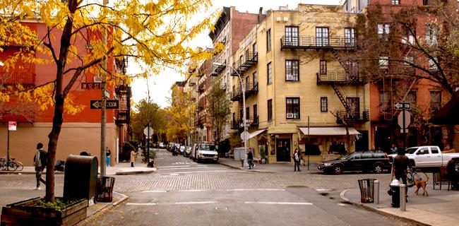
Image Source: wp.zillowstatic.com
5Grand Central Station
Advertisement
Also known as Grand Central Terminal, it is an intercity railroad terminal situated at the 42nd St. and Park Avenue in Midtown Manhattan. It serves people travelling on Metro-north railroad to Putnam, Dutchess and Westchester counties in New York.
Here is the photo from the 1920s:
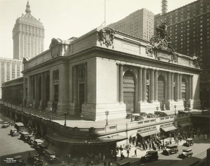
Image Source: www.boweryboyshistory.com
This is the Grand Central Station of today:
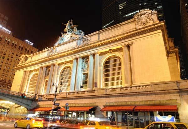
Image Source: www.carltonleisure.com